


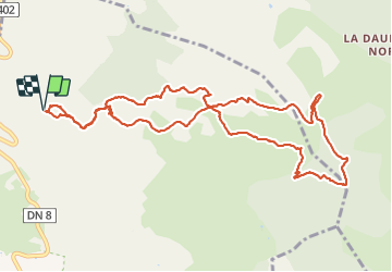


14,8 km | 19,6 km-effort

Usuario


Aplicación GPS de excursión GRATIS
 SityTrail
IGN / Institutos geográficos
SityTrail World
El mundo es suyo
Ruta Senderismo de 12,7 km a descubrir en Provenza-Alpes-Costa Azul, Var, Le Beausset. Esta ruta ha sido propuesta por Daniel.BRUN-PICARD.
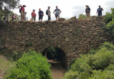
Belle randonnée sans difficulté à travers les vallons et la forêt. Merci aux accompagnateurs du Touring Club du Var qui on guidé le groupe tout au long de ce parcour.


Senderismo

Senderismo

Senderismo
Senderismo

Senderismo

Senderismo

Senderismo

Senderismo
Senderismo